
Coconut Creek ZIP Coverage
Three standard delivery ZIPs are verified for Coconut Creek. They describe USPS routing, not the incorporated boundary. The table gives the strongest documented local anchors. It should not be read as a parcel-by-parcel boundary list.
| ZIP | Coconut Creek Areas | Post Office | Local Note |
|---|---|---|---|
| 33063 | Southern city, City Hall and Copans corridor, Township | Margate Post Office | Shared with Margate; strongest city-label mismatch |
| 33066 | Central and eastern city, especially Wynmoor and Avenue of Stars | No Coconut Creek-named facility verified | Wynmoor public office uses this ZIP |
| 33073 | Northern city, Regency Lakes, Winston Park, Hillsboro and Wiles corridors | Coconut Creek Post Office | Only facility explicitly named Coconut Creek |
Use the USPS ZIP Code Lookup shown below to verify a city-and-state or full-address result before opening a records portal.
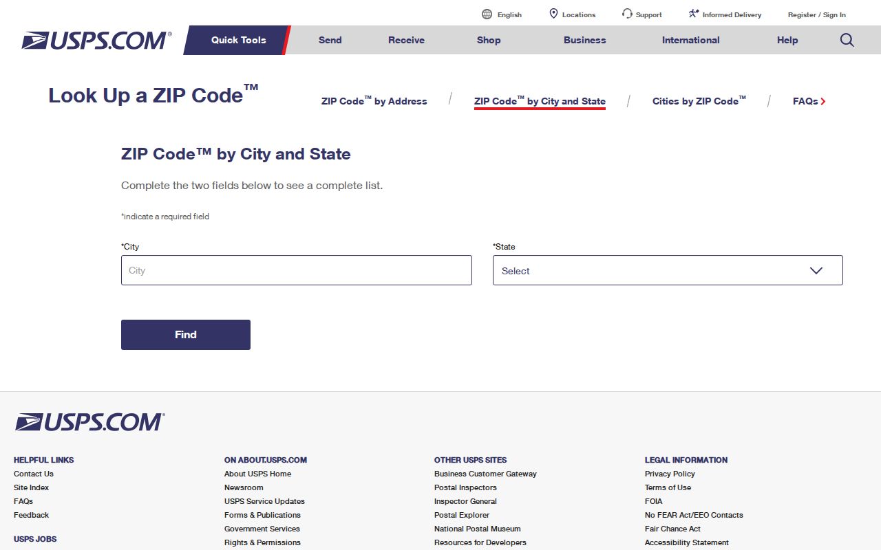
The official form resolves mail routing. It does not decide whether the point sits inside Coconut Creek city limits.
Why Coconut Creek Uses 33063
City Hall stands at 4800 West Copans Road and uses Coconut Creek, FL 33063, yet USPS names the serving facility the Margate Post Office. That office is at 5094 Coconut Creek Parkway, Margate, FL 33063-9998. Its documented retail hours are Monday through Friday from 9 a.m. to 5 p.m. and Saturday from 8 a.m. to noon.
This is the clearest Coconut Creek ZIP code directory warning. A street can carry the city's name, and a municipal building can use the ZIP, while the post office label still says Margate. Searchers should preserve both the exact mailing city and the physical address. The Broward Property Appraiser and Coconut Creek GIS can then settle parcel and municipal context.
Coconut Creek ZIP 33066
ZIP 33066 covers central and eastern Coconut Creek, with Wynmoor as the clearest verified anchor. Wynmoor's public office is at 1310 Avenue of Stars, Coconut Creek, FL 33066. No Coconut Creek-named USPS facility was verified for this ZIP, so the community address is stronger evidence than an assumed post-office title.
Community names and postal areas solve different problems. Wynmoor identifies a planned community. ZIP 33066 routes its mail. The city planning repository and parcel map can place the address inside a plat or development, while the tax roll identifies the physical situs. Public community documents may add services and association context, but gated member records are not a resident roster.
Note: A community address can confirm local context, but it does not prove that every address sharing its ZIP lies within the same development.
Northern Coconut Creek ZIP 33073
The northern part of Coconut Creek uses 33073, including Regency Lakes, Winston Park, and the Hillsboro and Wiles corridors. The Coconut Creek Post Office is at 4233 West Hillsboro Boulevard, 33073-9998, with phone number 954-428-0139. Documented hours are Monday through Friday from 8:30 a.m. to 5 p.m. and Saturday from 10 a.m. to 1 p.m.; post-office boxes are available around the clock.
This is the only verified USPS facility explicitly named Coconut Creek. Even so, a city-named station does not make the entire ZIP identical to the city. For a northern address, use the facility name as a postal anchor, then check the parcel in BCPA and the boundary in city GIS. Regency Lakes and Winston Park are useful geographic labels, not substitutes for a full address.
Find Coconut Creek Residents by ZIP
No local parcel-wide or voter-wide ZIP filter was verified in the research. A sound Coconut Creek ZIP code directory workflow therefore narrows through postal geography first and then uses the record's own accepted key. That limitation prevents false claims that BCPA or city GIS can list every household in one ZIP.
- Run the full address through USPS and save the preferred city, state, and five-digit ZIP.
- Search the Broward County Property Appraiser by street address. Keep the folio, exact situs, owner spelling, legal description, and mailing address.
- Open the Coconut Creek public GIS by address or intersection to check municipal and community context.
- If statistical geography matters, use a Census geocoder result and label any ZCTA data as statistical, not postal.
- Once the ZIP is narrowed to an address or road, continue with the Coconut Creek street directory.
BCPA's situs is the physical parcel. The owner mailing field is where tax mail goes and can use another city or state. A match between the two may support an owner-occupancy inference, but it does not list renters or the full household.
Coconut Creek ZIP Search Fields
The USPS form is the correct ZIP-capable resident-address source captured for this page. City GIS accepts an address or an intersection but shows no ZIP filter. BCPA accepts owner, address, subdivision, and property ID rather than a verified ZIP-wide household query. Sunbiz does offer ZIP and street modes, but it returns business entities and filing roles, not residents.
| Search Source | Input | What It Confirms | Limit |
|---|---|---|---|
| USPS Lookup | City and state, or full address | Preferred mailing form and ZIP | Not a city-boundary ruling |
| BCPA Property Search | Owner, address, subdivision, property ID | Parcel situs, folio, owner and mail address | No verified ZIP-wide mode |
| Coconut Creek GIS | Address or intersection | Mapped city and planning context | No ZIP filter shown |
| Sunbiz | ZIP, street, entity, officer or agent | Business filing address and role | Not a household directory |
A business filing address is an affiliation clue only. It cannot establish that the officer, agent, or owner lives there.
Coconut Creek ZIPs and City Limits
ZIPs are made for mail delivery. City limits define municipal jurisdiction. Census ZIP Code Tabulation Areas, called ZCTAs, are generalized shapes used for statistics. These three boundaries can overlap without matching. That is why a ZIP match alone does not prove Coconut Creek residence.
- ZIP code
- A five-digit USPS routing code assigned to delivery addresses and post-office boxes.
- ZIP+4
- The five-digit code plus four digits that narrow mail to a segment, building, or other delivery unit.
- PO-box ZIP
- A code used for post-office boxes rather than a mapped neighborhood delivery area.
- Unique ZIP
- A code assigned to one large institution or recipient. None was verified for Coconut Creek.
- Carrier route
- A set of delivery stops served by a postal carrier. It is not a city ward or parcel boundary.
The Census address search takes a street with city and state or a ZIP. Its geocoder also needs a benchmark and vintage for reproducible statistical results. A ZCTA population should never be labeled the exact population served by USPS.
Why 33093 Is Not Coconut Creek
ZIP 33093 appears in authoritative material as Margate post-office-box addressing. The research found no basis for calling it a Coconut Creek neighborhood delivery ZIP. A box holder may live or do business in Coconut Creek, but the box number does not identify a home parcel.
The same caution applies to any number found in a scanned form, business filing, or owner mailing address. First decide what the field means. A situs ZIP locates the parcel's physical address. An owner mailing ZIP points to correspondence. A PO-box ZIP points to the box facility. Only the first of these directly describes the site being researched.
Coconut Creek ZIPs Meet Folios
After postal verification, the Broward folio is the best bridge into property records. Folios are generally 12-character identifiers. Condominium examples can include letters, so a digits-only form can wrongly reject a valid parcel number. The legal description and plat supply a stable land identity when a mailing form, street suffix, or community label changes.
Keep four fields separate: USPS mailing form, BCPA situs, owner mailing address, and legal description. Then record the date of each search. This is especially useful in planned communities such as Township, Wynmoor, Centura Parc, Regency Lakes, Winston Park, Banyan Trails, Victoria Isles, and Coconut Creek Ranches. Planning maps can match the informal community name to a project folder or plat without claiming to reveal residents.
Note: No verified Coconut Creek ZIP split, realignment year, or unique institutional ZIP was found, so none should be inferred from present boundaries.
Coconut Creek ZIP Context
Coconut Creek covered 11.17 land square miles in the 2020 Census and had 57,833 people. The 2025 estimate was 58,626, with 24,304 households in the 2020–24 estimate period. These citywide figures explain why a ZIP search can still leave many possible names. They do not break down exact USPS delivery populations for 33063, 33066, or 33073.
Address stability is also an aggregate, not proof about one home. The estimate that 85.1 percent of residents lived in the same home as a year earlier cannot verify an individual. The 64.8 percent owner-occupied rate explains why parcel records cover many Coconut Creek households while still missing renters and other occupants. Use figures for scale, then return to the exact address and dated official source.
The Coconut Creek ZIP code directory is strongest as a geographic filter. USPS confirms routing, BCPA identifies land, city GIS establishes local map context, and Census tools serve statistical work. None is a complete resident list on its own.